
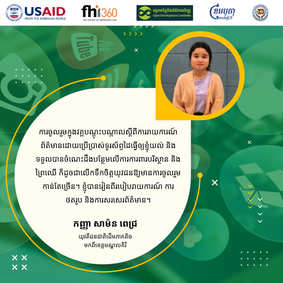
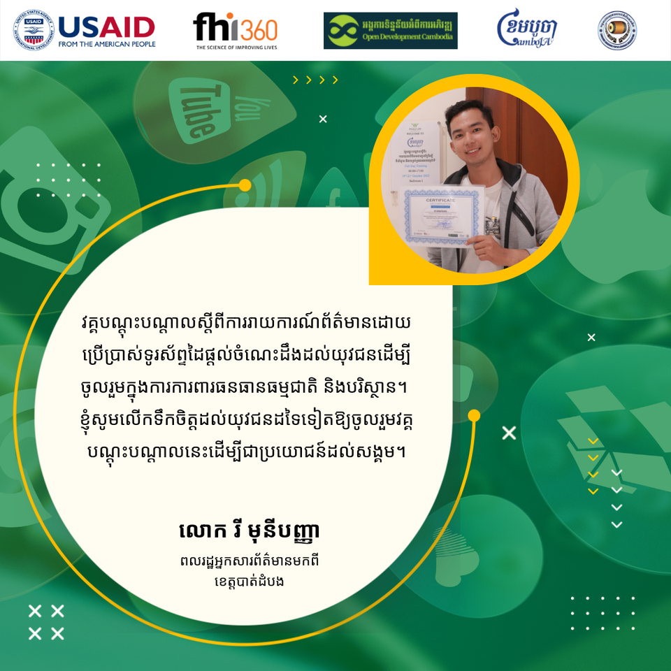
Would you like to know what our young indigenous woman and citizen journalist think about the mobile report training? Let’s have a look at their testimonials together!
This activity is under the Civil Society Support Activity: Cluster Anchor Grants, founded by USAID Cambodia through FHI 360.
Other Stories
Sixth Science Talk on the drought situation in Cambodia
CamboJA, in collaboration with the Open Development Cambodia Organization (ODC), organized the 6th Science Talk on the Drought Situation in Cambodia on 30 January 2024. The event was attended by 35 participants (19 women), including representatives of civil society organizations, university students, and journalists. Thank Mr. Hour Ix, Reginal Drought Management Expert of the Mekong River Commission (MRC), for sharing his experience, knowledge, and expertise on this topic. This activity is funded by USAID through FHI360, under the Civil Society Support (CSS) project, and co-implemented by CamboJA and the Open Development Cambodia Organization (ODC).
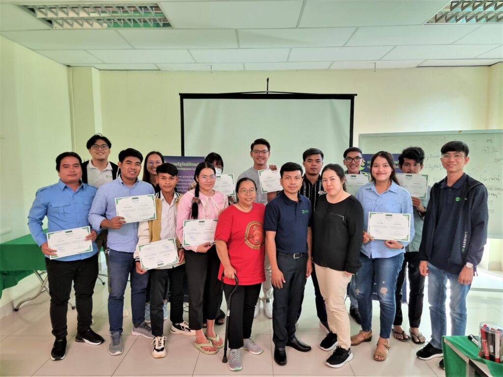
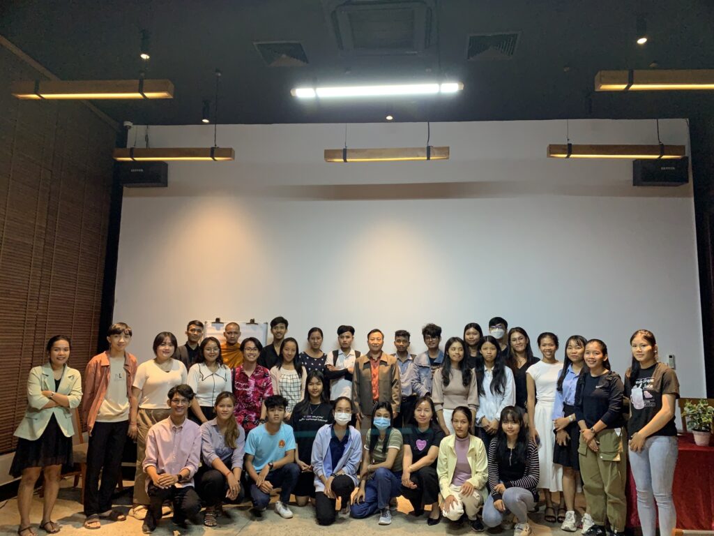
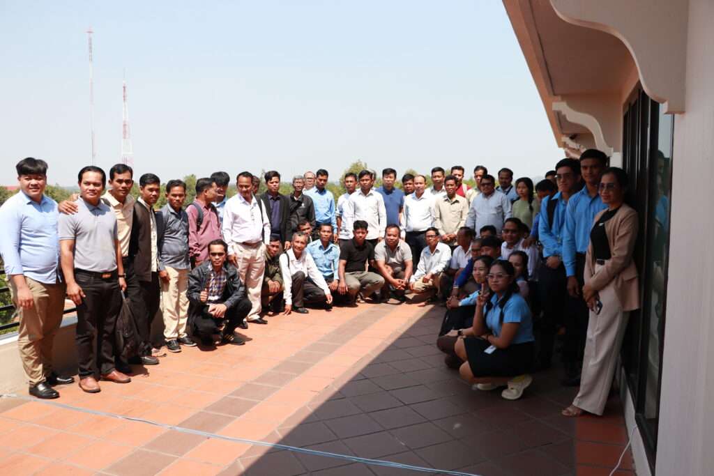
Data visualization and storytelling training
Open Development Cambodia (ODC) hosted a training on \"Data visualization and storytelling\" on December 20-21 and 26, 2022, with 24 participants, including journalists, citizen journalists, indigenous youth journalists, journalism students, and CSOs. People with disabilities and LGBTQIA+ are encouraged to join. This training was divided into two parts. The first stage was a two-day online training that included lessons and exercises. The second phase was a one-day physical training session focused on recapping the entire training and exercises. This training was funded by USAID Cambodia through FHI 360 as part of the Civil Society Support (CSS) Project\'s Cluster Anchor Grant. Day 01: Understanding data Before the session began, an ODC representative made a welcoming remark about the project and an introduction to help the attendees get to know one another. Following that, the participant spent time preparing for the pre-test, which was used to assess their capacity before the program began. Mr. Vong Pisith, the trainer, began the lesson on understanding data to provide insight into the importance of data, the different types of data and information, and the transparency of open data. After everyone understood the data well, the trainers demonstrated how to find it using the data portal and Google advanced search. The participants were then given an exercise by finding their needs data in PDF format and other natural resource data on the ODC portal. The trainer, Mr. BAN Chanphalla, then moved on to the next lesson on data standardization, which instructed the participants about data standards and how to format their data before diving into data visualization. The participants were introduced to the function of creating a new spreadsheet, adding sheets, making a copy, columns, and rows, inserting charts, filtering, and pivoting tables on google sheets, as well as importing comma-separated values (CSV) files into the spreadsheet and Microsoft Excel. The trainers also illustrated the data clean as a significant part of the data analysis. This lesson explained why we need to clean data and introduced them to a method for cleaning data to make it legible by introducing techniques such as trimming whitespace, removing duplicates, formatting text, splitting columns, data validation, and finding and replacing. Day 02: Data visualization On the second training day, the trainers took a few minutes to review the previous day\'s lesson before continuing with Mr. Sam An Mardy\'s agenda on data visualization principles. The trainer will introduce what motivated us to create the visualization, what exactly the data visualization is, how to tell a data-driven story, how to choose the right graph and chart type, and how to display it correctly. Mr. Vong Pisith then showed the participants a demonstration and examples of the Flourish. The participants then continue working on the group exercise to create the chart and graph with Flourish. Everyone took the post-test at the end of the second day and looked forward to the physical training on the third day. Day 03: Individual practice The agenda for the last day of training covered lesson reminiscence. Everyone attended the physical training and continued the lesson on data visualization with Flourish. The participants started learning how to make a map chart out of geographical data and how to incorporate those visualizations into the story. Then the participants were given the opportunity to practice it independently and complete the individual assignment by creating storytelling using data visualization. Finally, the trainees were asked to evaluate before closing remarks and provide the training certificates.
Civil society’s participation in the draft Land Law dialogue for land rights protection
The Cambodian government has drafted an entirely new Land Law (the draft law), more than 20 years after the promulgation of the 2001 Land Law. Acknowledging the importance of participation from civil society, local communities, and indigenous peoples (IPs), Open Development Cambodia (ODC) formally sought an opportunity to review the draft law and was able to provide constructive inputs based on dialogues with relevant stakeholders. In late January 2024, the Ministry of Land Management, Urban Planning and Construction (MLMUPC) drafted a comprehensive new Land Law, comprising seven titles, thirteen chapters, and a total of one hundred and ninety-nine articles. ODC formally submitted an official letter to the MLMUPC, requesting an opportunity to review and provide constructive inputs on the draft law. The MLMUPC approved the request and shared the draft law with ODC, providing a short window until 16 February 2024 for submitting inputs. Dialogues highlighting key issues such as the need to protect collective rights, in particular, the rights of Indigenous peoples ODC hosted two dialogues on the draft new Land Law – one on 13-14 February in Siem Reap Province and another on 15 February in Phnom Penh. The two dialogues were supported by the United States Agency for International Development (USAID) through Family Health International (FHI 360) under a Cluster Anchor Grant from the Civil Society Support (CSS) Project, ALIGN and LANDESA. During the first dialogue, a Cambodian legal expert presented an analysis of key articles of the draft Land Law to the participants. The participants then discussed and provided their inputs, concerns, and recommendations for the draft law. Representatives from Indigenous peoples’ (IP) communities who were present during the dialogue raised concerns about the limited time provided for comprehending the proposed legal amendments, conveying their understanding to the communities, and gathering inputs from their members. They felt that the dialogue was more of an informative session than a consultative one. As a result, representatives from the indigenous communities were unable to provide their input on the draft law and requested an extension of time for the consultation process. ODC and our partners sympathized with the response from the IP communities, as the timeline for the input was also a huge challenge for the team. The second dialogue was held on 15 February in Phnom Penh, to consolidate the inputs and recommendations derived from the first dialogue in Siem Reap Province. Following the dialogues, ODC and partners prepared and submitted the consolidated inputs and recommendations to the MLMUPC. The document is published on the ODC website, and is publicly accessible. The document highlights several key issues, such as the need to clarify the protection guarantees for collective ownership, right to use, right to enjoy the fruit of the land and rights related to land and other immovable properties of IPs and Buddhist monasteries. The input also requested further consideration towards gender equity and the protection of the rights of IPs and local communities. In early March, ODC attended a meeting hosted by the Land Law Working Group at the MLMUPC. According to the MLMUPC, more than 15 inputs from ODC were incorporated, including issues regarding the classification of public state land and private state land, the timeframe for the registration of communal land titles for IPs, promotion of equity in land rights and land administration, the specification of a timeframe for complaints, a filing process for complaints, and elaboration on the glossary. ODC and our partners shared concerns regarding the time window for the submission of input. The time window for translating the draft law into English and sharing it with our international legal experts, as well as holding dialogues, meant that the input document did not cover all the key points as thoroughly as it could have, if more time were given in the first round. After the input submission, ODC hosted additional discussions and meetings and collaborated with partner organizations to gather more inputs. On 11 March 2024, ODC hosted a knowledge sharing session on Women\'s Rights in Land Ownership and Natural Resource Management (NRM). Additionally, on 22 March 2024, ODC attended a meeting held by the Land Law Working Group of the MLMUPC to discuss the inputs that the working group has received so far. On 26 March 2024, ODC attended another workshop hosted by MLMUPC on the draft law. Then, on 26 April 2024, ODC and partner organizations supported a meeting organized by My Village (MVi) for consultation on the draft law, focusing on the process and challenges of indigenous communal land titling. According to a Ministry officer, MLMUPC will continue to review and incorporate inputs as appropriate and will share a further revised draft law with relevant stakeholders. Based on that advice, ODC and partner organizations continued to review and collect further inputs for the revised version of the draft law and submitted our second round of inputs on the revised draft law on 7 June 2024. On 19 June after submission of our inputs on the revised draft law, MLMUPC shared with ODC the latest version of the draft law. ODC observed that none of our second round of inputs were taken and incorporated in the latest draft. ODC and partner organizations wish to be given further opportunity for a more constructive and serious consultation with the MLMUPC to discuss our inputs point by point. The importance of national and international alliances to ensure an inclusive land law reform that protects the rights of all citizens The collaboration with ALIGN and LANDESA has enabled ODC to engage in consultations with national and international stakeholders on the land law reform process in Cambodia, aligning with relevant international standards and principles of responsible investment in land governance. By uniting all stakeholders, ODC tries to promote transparency and responsible investment in land in Cambodia. The inputs submitted by ODC amplify the voices of local communities to the government, an important factor for promoting sustainability and inclusivity in land rights for every Cambodian. While not all inputs and recommendations from ODC and our partners are expected to be taken by the government, the collaboration has sparked important discussions, particularly concerning land rights and land administration among underrepresented groups such as IPs, women, widowers, and LGBTQ+ individuals. Moving forward, ODC commits to continue working with partner organizations and stakeholders to discuss and explain our second round of inputs and provide more precise and complete suggested changes to the draft law to ensure that the new law is enabling, inclusive, equitable and effective, with minimized unintended negative impacts on vulnerable groups such as traditionally separated spouses, IPs and their communities, LGBTQ+ and unregistered land possessors, and avoiding regulatory or administrative taking of land and immovable property rights without fair and just compensation.